
 Prepare for Trails
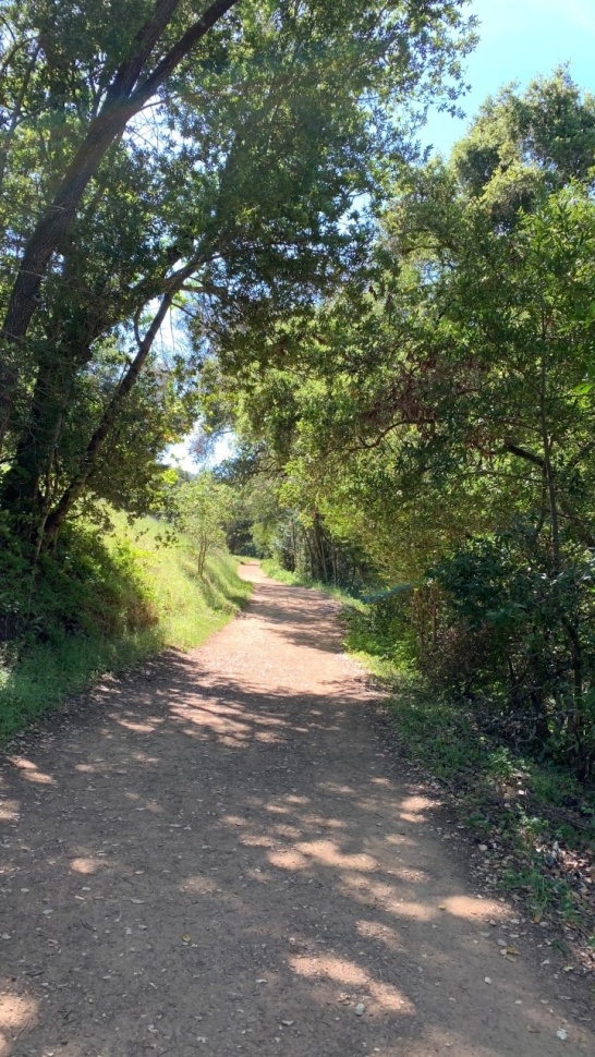
We're extremely lucky to live close by great trails in the Bay Area. Many trails can have technical sections, and trail apps don’t always share the information you need to prepare.
Training on new terrain and experiencing different elevations can help keep your body agile. This can improve your adaptability during races and training.
Tips
- Save Phone Numbers: Be sure to save ranger numbers in case of an emergency and happen to have reception if you find yourself in that emergency.
- Borrow a Hotspot: Taking one of our free Wi-Fi hotspots might help in an emergency situation.
- Download Maps: Be sure to download map information because you may not have reception during your hike/ run.
- Borrow a Free CA Park Pass: San José Public Library offers Park Passes. Our free Park Passes offer free parking at participating parks in California. Please check out the website for non-participating and participating parks.
Local Recommendations to Enjoy
Rancho San Antonio
This park has easier trails in the front of the park, which is a nice introduction. There are more intense trails but toward the mid-rear of the open space. There is a farm at this open space, currently with fewer livestock since the pandemic. Check hours of operation if you plan to visit the farm.
There's free parking, but parking can be difficult depending on the time you arrive.
The wildlife is not afraid here. Deer and other wildlife come close to humans. I have encountered deer, fox, coyote and turkey. Main parking lots have running water and flushing toilets. Soap is not always available and there are no napkins or seat covers. Mid-section of the hike (Deer Hallow Farm area), have bolted down toilets. with no sink or running water. Depending on the time of day this is a busy place to visit.
TRAIL INFO
Estimated time 2-2.5 hours/ 5 miles moderate to difficult (section have breaks with little to no incline or decline)
Start from Deer Hollow Farm trailhead.
Make a right onto Permanente Creek trail and veer slight right onto Rancho San Antonio service Rd. about a half a mile down. Make a slight right onto Lower Meadow trail and make a sharp right onto Mora Trail. Mora trail is a long uphill. Follow Mora trail until you reach Ravensbury trail. Make a left onto Ravensbury trail. When you reach a split section of trail keep left and merge into Rouge Valley trail. Make a right towards Wild Cat Loop trail. Make a left onto Coyote trail. Follow Coyote trail for about 1.5 miles until you meet PG& Electric trail down. (do you follow PG& Electric trail uphill) Make a left onto Permanente Trail and this will lead you back to the trailhead.
Estimated time: 2.5-3 hours/ 8 miles moderate to very difficult
Follow the same route when you meet Wild Cat Loop trail continue onto Upper Wild Cat canyon trail. You stay on Upper Wild Cat canyon trail until you meet High Meadow trail. Make a right onto High meadow trail. Stay on High Meadow trail until you reach Coyote trail. Follow the same trails as listed above. You will reach back to trailhead.
PARK INFO
- Hours: Open a half-hour before official sunrise until a half-hour after official sunset
- Main office 650-691-1200/ Emergency 911
- NO DOGS PERMITED: Designated areas
- BICYCLES ALLOWED
Los Gatos Creek Trail / St. Joseph Hill
This is where my hiking/trail running journey began. There are a few trails I would highly recommend. Depending on which trails you choose there could be limited shade, so bring a hat/cap. This open space is also versatile and is a shared trail; you can come across many mountain bikers, so be cautious. I have come across, snakes and chipmunks here.
* Free street parking / timed parking off main street. Lexington reservoir fee parking. Porta-potty restrooms with pump sinks @Lexington reservoir.
TRAIL INFO
Estimated time 1.5-2 hours under 5 miles easy to moderate
Start at Lexington Dam Loop Trailhead off Main St. continue straight onto Los Gatos Creek trail. Follow the trail for about 1.5-2 miles down until you reach Alma Bridge Rd. Make a left onto Alma Bridge Rd. You stay on the dirt shoulder. This connects to Jones trail which you follow all the way down until you reach the neighborhood. Continue on Jones Rd. Left onto College Ave. Follow College Ave. until you reach Main St.
Estimated time 1.5-2 hours 5 miles easy to moderate *Bikes are allowed on all trails listed minus Serpentine trail
*From Lexington Reservoir parking fee parking
Start at St. Joseph hill trailhead. You are on Jones hill trail which you will follow down until you reach Novitiate trail. Make a right onto Novitiate trail. Merge onto Range trail which turns into Brother's bypass towards Manzanita trail. (This portion of the route does have many uphill with breaks in between) Continue on Manzanita trail until you reach Serpentine trail. You will meet Manzanita trail and make a right. Follow down the trail until you reach Novitiate trail and make a left. You will reach Jones trail about a miles or so down to the trailhead.
*Jones trail is fairly steep at the beginning and Range trail to Brother's bypass has a long ascending uphill.
PARK INFO
- Hours: Open a half-hour before sunrise until a half-hour after sunset.
- In case of emergency, call 24-hour emergency dispatch at 650-968-4411 or 911.
- DOGS ALLOWED: Leashed
- BICYCLES ALLOWED: Designated areas
Almaden Quicksilver
This is a very versatile trail running/ hiking spot. You can easily add more miles to increase the intensity/ mileage to meet your needs. The detailed mileage, on their website, will help plan your route. Download the map to use offline. Many routes are well shaded at Almaden Quicksilver but make sure you have a cap/ hat. Trail difficulty is not listed, but you can always check trail apps for more technical information. Restrooms (Porta-potties) are only available at main trail heads (Hacienda and McAbee trailheads). There are pump sinks and Porta-potties are maintained regularly. No running water here. Mountain bikers are allowed in some sections of the trail, be cautious. I have come across bobcats, fox, rattlesnakes, deer, tarantulas, salamanders, coyotes and turkey during runs/ hikes.
TRAIL INFO
Estimated time 1-2.5 hours/ 5 miles easy to moderate
Start at the trailhead from McAbee Rd. Senador Mine Trail is the trail you will begin on. Continue on until you reach a small trail, New Almaden Trail. Turn left onto New Almaden Trail (this small trail is steep). There is a connection of trails at the top, which you will make a right onto Guadalupe Trail. Guadalupe trail will meet Senador Mine trail towards the end of the trail. You will make a left to continue onto Guadalupe Trail. The route has lots of uphill but will have few breaks in between. Continue on to Guadalupe Trail. There is a pretty long/ steep climb mid section on Guadalupe Trail (at mile 2.5-3). Continue on and make a left onto Mine Hill trail, this will loop back to the trail head.
Estimated time 2-3 hours/ 7-8 miles moderate to difficult
Mine Hill Trail continues upward. This trail is mainly uphill. Once you meet Prospect #3 you turn back and backtrack. When you reach Mine Hill Trail you veer right. This will lead you back to the trail head.
*Mountain bikers are allowed on the trail after Randol Trail which you will pass going uphill on your left. There will be signs posted were bikes are allowed on the trail.
Estimated time 3-3.5 hours 10 miles moderate to difficult *LOOP*
When you reached Prospect #3, make a left onto this trail. This is a narrow trail which is mainly downhill and bikes are allowed on this trail. You will make a left onto Randol Trail. Continue until you reach Mine Hill Trail and make a right. Keep to your right on Mine Hill Trail. This will lead you right back to the trail head.
Estiamted time 3-4 hours 10 miles moderate to very difficult *LOOP*
*This route will mainly consist of uphill.
Start at Senador Mine Trail and make a left onto Mine Hill Trail instead of heading straight. Turn left onto New Almaden Trail and continue on for 4 miles or so. There is a very steep uphill section which connects to Prospect #3 Trail. You will continue onto Prospect#3 and turn right onto Mine Hill Trail (all uphill). Veer left onto Guadalupe Trail and continue on. There will be another steep uphill right before you meet Senador Mine Trail. Make a right onto Guadalupe trail and follow the trial down. Keep straight onto Mine Hill Trail and this will lead you to the trail head.
PARK INFO
- *Neighborhood parking in many sections of this trail and free parking at Hacienda trailhead entrance.
- Park Hours: 8:00 AM until sunset Trail Hours: Sunrise to sunset
- Ranger Station and Visitor Station: (408) 535-4070 Trail Hotline: (408) 355-2200
- DOGS ALLOWED ON LEASH (EXCEPT CASA GRANDE)
Castle Rock
Castle Rock park has such breathtaking views. You start at a higher elevation and the trails are more rugged. There’s a parking fee of $10 or check out our Parks pass from San Jose Public library. There is also parking off Hwy. 35, come early. Careful crossing here, cars pass quickly since it is a hwy. Flushing restrooms at the main parking lot, no soap/ no napkins/no seat covers. Always ask if there are trail closures before starting. There might be some information on their website regarding trail closures. You will climb on boulders/rocks during some sections of the trail and some trails are right next to the edge. This is a 5+ mile loop which is medium- difficult for newbies. Lots of uphill and climbing on top of boulders. There are shaded areas on some sections of the trail. If you take the trail to goat rock from Saratoga Gap, you will have lots of sun. Pockets of shade along the perimeter of the trail. Shade comes later in the hike. Bring a hat/ cap. The trail can be pretty narrow on Saratoga gap. Some sections you may find yourself letting people pass or them letting you pass. Map available on trail apps. and there is a map at the main trailhead.
TRAIL INFO
Estimated time 2-3 hours 5 miles moderate to very difficult *LOOP*
Start on Saratoga gap trail towards Castle Rock Falls Vista Point (Water fall look out/ no water). Continue on Saratoga gap trail. This trail can be a little misleading to be sure you follow the trail and not off a cliff. Saratoga Gap trail is narrow and right next to a drop once you pass Castle Rock Falls Vista Point. You will climb on rocks, boulders and this route is moderate to very difficult. Continue to follow the trail closest to drop off. Keep left and there will be times where you will need to let others pass or vise versa. When you reach Ridge trail turn right and follow towards Goat rock. You will loop back to Saratoga Gap trail and follow it back up to parking lot area.
PARK INFO
- Kirkwood Entrance Station Hours: 8:00 AM to 5:00 PM, Monday through Sunday
- Day Use Hours: 6:00 AM to Sunset.
- Emergency call 911
- BICYCLES are allowed on the Skyline Trail (Bay Area Ridge Trail) located on the north side of Highway 35.
- DOGS are prohibited throughout the park (except for service animals). Nearby Sanborn County Park allows dogs.
- CELL SERVICE: Little to NO reception
*Gun range close by. Depending on the trail you choose you may hear gun range. This awkward noise in a serene trek, does not last long.
Non-Local Recommendations - Not in San Jose, but must-try trails
Muir Woods
There is access from Muir woods to Mt. Tam, this a nicely manicured trail. Many of the sections of the trail are well kept. The weather can be pretty nice even on hot days since the bay is close. You can see the coast on a clear day from higher sections of the trail. The map available online does not show the mileage but trails are marked well. The map at Muir woods that is given does not show the mileage either.
Websites do not show mileage to plan out your run/ hike I would recommend a GPS watch. There are times the trails may have closures, be sure to ask ahead of time or check on the website. I've trekked the same trail and added a few more miles depending on what mileage I would like to achieve. This trail can be moderate - difficult for beginners. The trail is mainly uphill with breaks in between. Some sections of the trail consist of narrow areas & bridges which will require you or others hiking to let pass. Since this Redwood park is considered a first grove, there are times were the wind kick up and can get cold. The trail is well shaded and you will get some sun after the uphill portion, bring a hat/ cap. No restrooms on the trail. Flushing restrooms at the beginning of the trail with soap and no seat covers. Second overflow parking lot have Porta potty’s with pump no sink.
TRAIL INFO
Estimated time 1.5-2 hours/ 5 mile trail at Muir woods
Start at Muir woods Monument entrance. Main trail to bridge one (left). Keep to the left and turn onto Hillside trail. This trail is mainly uphill. I would say moderate, a level 5-6 of 10 for beginners. There are some breaks within the trail but mainly uphill. Veer left towards Ben Johnson Trail. There will be an open space with a bench, you will continue upward left to Ben Johnson Trail. This switchback portion can be steep uphill leading to Dipsea trail. Left onto Dipsea trail which merges to Deer Park Fire Rd. Stay on Deer Park Fire Rd. This section can be a bit confusing since you have the option to stay on Dipsea Trail or Deer Park Fire Rd.There is a connection to Dipsea Trail which is not very visible to your left. If you miss this connection, don't worry. If continue down until you reach Frank Valley Rd. and cross the Rd., make a left on Frank Valley Rd. to head back towards parking. This is a loop trail which will bring you back to the second overflow parking and if you happen to miss the Dipsea Trail connection.
*There's some trail work currently on this switchback portion during the week until February 2023. Switchback section, open on weekends. Bikes are allowed on Deer Park Fire Rd.
PARK INFO
- Please visit gomuirwoods.com for reservations. Starting Saturday, May 28 our new operating hours will be 8:00 AM - 8:00 PM. The Muir Woods Visitor Center is open 8:00 AM to 30 minutes before the park closes.
- *Parking fees. Parking off the Panoramic hwy. is an option but that may add on 3 miles to get to the main park entrance. Parking reservations are a must to not be turned away when you arrive. (Last updated 9/26/22)
- Muir Wood Park Hours: 8:00 AM - 8:00 PM
- Mt. Tam Hours: Daily: 7:00 AM to Sunset, year round.
- There is no cell phone service at Muir Woods.
Tip: I have taken a hotspot here and it works in the parking lot, specifically the first overflow parking from the main entrance. - Pets are not permitted in Muir Woods.
Trying soon:
Big Sur - Mount Manuel Trail
Beginning at the Oak Grove Trail, 8 miles’ roundtrip, strenuous. A steep, beautiful climb to the top of 3,379 foot Manuel Peak.
Portola Redwoods - Peters Creek Loop
Trailhead: Old Tree Trail; 11.9 miles roundtrip; elevation change 1,030 feet. Peters Creek Loop passes through a seldom-seen area of the park that is home to some of the region’s oldest redwoods. Try it either as a day trip or a short backpacking expedition.
From the Old Tree trailhead, follow the signs for Slate Creek Trail. At Trail Camp in 2.5 miles, veer left on Bear Creek Trail for another 2.5 miles or so. Make the loop around the grove and backtrack on Bear Creek and Slate Creek trails to return.
Always wanted to try this route.
Almaden Quicksilver to Sierra Azul (Mt. Umunum)
This trail will be close to marathon miles, 23.2. I have not gone to Mt. Umunum but am pretty familiar with Almaden Quicksilver portion. I always chatted with one of my siblings on running/ hiking over to Mt. Umunum from Quicksilver. There are many trails we will take on this one but you can see the trek on trail apps. TBD
Check out my Blogs for more tips.


Add a comment to: Bay Area Trails